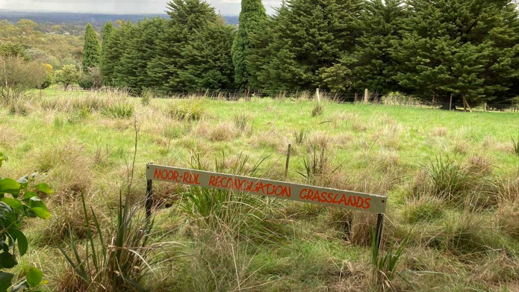


The Moor-rul Grasslands are a remnant area of native grass cover. Alongside is the Moor-rul Viewing Platform with panoramic views and information panels about Aboriginal and European history, geology, and local flora and fauna.
The Moor-rul Grasslands Project
The Friends of Moor-rul Reconciliation Grasslands was formed to care for the small section of land next to the viewing platform at the Kangaroo Ground Memorial Park Tower. The group is supported by the Environmental Works Unit of Nillumbik Shire.
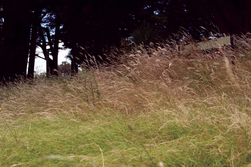
The grasslands are surrounded by a rabbit proof fence, and have been regenerated with plants indigenous to the area; originally this place would been covered by grasses such as Weeping, Kangaroo and Wallaby grass species.
Some remnants of the original grass cover remain, and a major weeding program has rid the area of Capeweed, Plantain, Oxalis, Briza and other noxious weeds to allow the plants already there to seed and germinate in the cleared areas. A cool burn of some annual grasses before seeding has also been experimented with.
A plan developed by a local expert guides how areas are planted at appropriate times. Plants have been propagated as required in the Edendale Farm nursery.
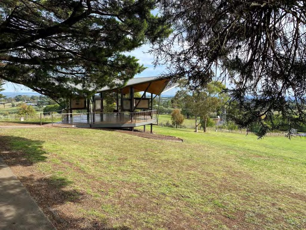
The Moor-rul Viewing Platform

The Moor-rul Viewing Platform was officially opened on 17th April, 2008 – in the presence of the Hon Jenny Macklin, MP – shortly after the launch of the Shire’s Reconciliation Charter.
The platform provides shelter for people visiting the park whilst also giving stunning panoramic views without people needing to negotiate the stairs of the lookout tower. From the platform you can see the Dandenongs, the city of Melbourne, the You Yangs, Mount Macedon, the Kinglake Ranges and the Mt Baw-Baw Ranges where the Yarra River starts. This landscape covers all the ancestral lands of the Wurundjeri and some of the wider Kulin nation land.
The platform has been given the name Moor-rul, a name which described the fertile soils of the Kangaroo Ground area in contrast to the poorer (Silurian) country of its surrounds, which the Wurundjeri knew as Nillumbik or less-rich country.
The full 360 degree view can be seen from the top of the adjacent Tower of Remembrance, which has 53 stairs. The viewing platform, however, can be accessed by wheelchair.
Inside the viewing platform, eight double-sided interpretive panels set out the Aboriginal and European history of the area, and also the geology and local flora and fauna, so that the casual visitor comes away understanding more about this significant part of Victoria.
History of the Site
The area now known as Kangaroo Ground is part of the Wurundjeri lands, and there is evidence that the Wurundjeri managed the landscape with fire to create open grounds for hunting and plant cultivation. Unfortunately, there is limited written evidence about other aspects of their occupation in this area.
Dispossession of the Wurundjeri began in the mid-1830s with pastoralists using various strategies to drive them from their lands. Squatters actively destroyed Aboriginal people’s means of livelihood including their houses, encampments and fish traps. Stock trampled and destroyed Aboriginal food plants and waterholes, and traditional game was driven away, leading to starvation and conflict. The gold rushes in the 1850s further accelerated the decline of the Aboriginal population in this area.
The Kangaroo Ground run, in which the summit later known as Garden Hill was located, was held by different owners, investors and lessees from 1840, with cultivation areas established on the ridge. The area was surveyed by the Government in the late 1840s, and key land parcels were purchased by investors and immigrants. The land was progressively cleared and cultivated, and by the late 19th century, the summit of Garden Hill had become a popular lookout and picnic area, known for its expansive views and featured on local tours.
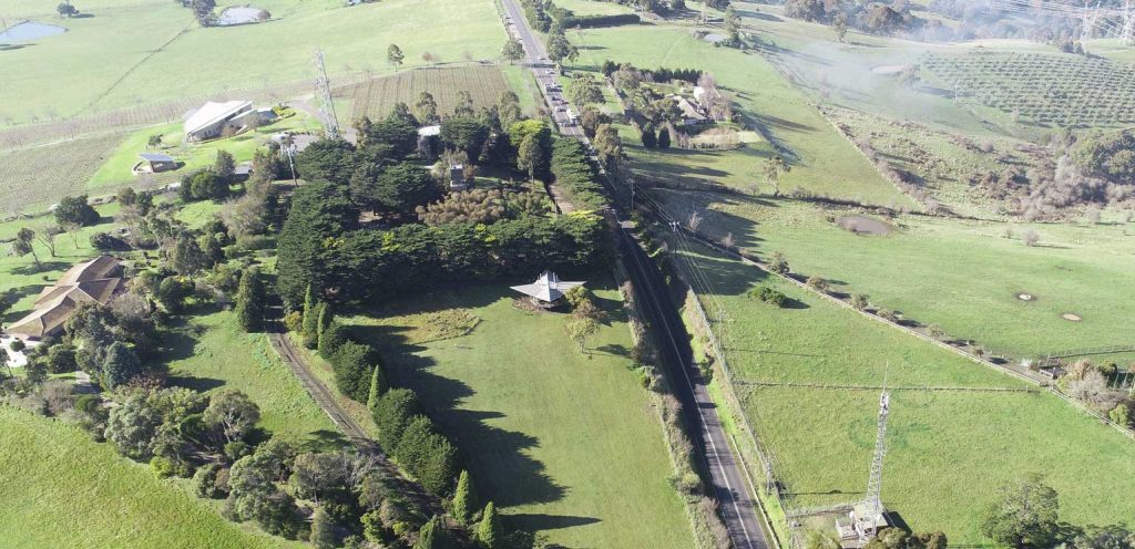
Eltham Shire councillors proposed a memorial park at Garden Hill during World War I, with an early memorial cairn for fallen soldiers from the district being followed by the current 40ft lookout tower in 1926. With the rise of motor travel, Garden Hill grew in popularity as a stop for day tours from Melbourne. The tower’s potential for fire spotting was also recognized, with the first fire spotter starting there in 1948.
The Shire of Eltham purchased a block of land to the immediate west in 1973, with the intention of providing better road access to the park. In 2008 the Moor-rul viewing platform and Moor-rul Reconciliation Grasslands were established on the upper part of this land. In 2021 Council endorsed a draft management plan that identified a range of improvements to the park gardens, interpretive signage, caretakers cottage, tower, and removal and replacement of the heritage cypress trees.
How to visit
Connect
Events, workshops, and volunteer & support activities related to this site:
- Friends of Moor-rul Grasslands: For opportunities to be involved in caring for this place, please contact Jann Darvill on 03 9439 7342
- Moor-rul Grasslands on Facebook: https://www.facebook.com/moorrulgrasslands
Further Reading and References
- Edendale Farm Indigenous Plant Nursery: https://www.edendale.vic.gov.au/Nursery/
- Kangaroo Ground War Memorial Park Management Plan: https://participate.nillumbik.vic.gov.au/kgwmp